.
vessel BEKS LEO IMO: 9573115, Bulk Carrier vesseltracker.com
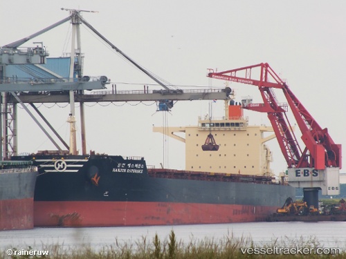
Vessel BEKS LEO IMO: 9573115, MMSI: 538009692 Bulk Carrier

callsign: V7A5050
size: x

Live AIS position: UTC. 41 nm S of Gobo Wakayama), updated 2026-01-04 22:20:39 UTC.

Find the position of the vessel BEKS LEO on the map. The latter are known coordinates and path.

marine traffic ship tracker show on live map

The current position of vessel BEKS LEO is 33.21113 lat / 135.23328 lng. Updated: 2026-01-04 22:20:39 UTC

Currently sailing under the flag of Marshall Islands

BEKS LEO built in 2012 year

Deadweight:
179147 t

Details:


Last coordinates of the vessel:
2026-01-04 22:20:39 UTC, 33.21113, 135.23328, course: 76, speed: 18.3

Track of the vessel in the last 28 days


Most frequent ports a vessels calls at BEKS LEO (538009692):

Selat Lombok, traffic: 6
Sambu, traffic: 3
Whyalla, traffic: 3
Lianyungang, traffic: 2
Newcastle, traffic: 1
Vitoria, traffic: 1
Yeosu, traffic: 1
Yosu, traffic: 1
Canakkale, traffic: 1
Tubarao, traffic: 1
Gelibolu, traffic: 1
Gladstone Harbor, traffic: 1

Link to the map:


Find another ship

BEKS_LEO (538009692) last ports (portcalls and passsages)

Gelibolu | 2024-01-07 12:46:49
Canakkale | 2024-01-07 10:59:29
Tubarao | 2023-12-16 23:27:57
Sambu | 2022-10-07 16:57:25
Gladstone Harbor | 2022-09-21 04:09:11
Yosu | 2022-08-30 01:30:32
Newcastle | 2022-08-07 04:48:00
Whyalla | 2022-04-03 08:28:10
Selat Lombok | 2022-03-13 06:06:00
Lianyungang | 2022-02-26 06:11:15
Selat Lombok | 2022-02-06 13:56:50
Whyalla | 2022-01-16 00:36:48
Selat Lombok | 2021-12-25 07:23:01
Sambu | 2021-12-04 16:26:25